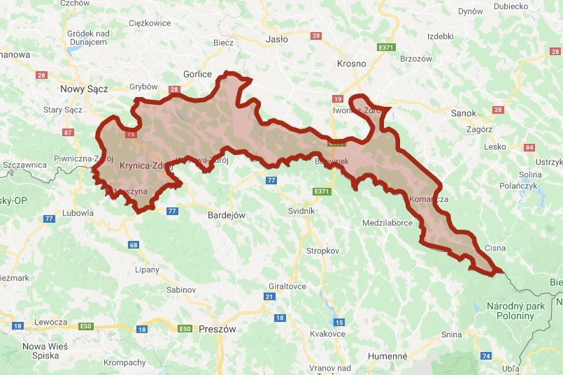

The Lemkos used to occupy the largest area of the Carpathians. The historical area of the Lemko region covers about 10 thousand km². On the east-west line it stretches on both sides of the Carpathian Foothills for a length of about 150 km, and from south to north about 60 km, and lies between 48 and 49 degrees north latitude. Ethnic borders of the Lemko region in Poland are distributed as follows: western: the Poprad River, eastern: watershed dividing the Osława valley from the upper Wisłok basin, northern: it was based in the Lemko villages: Wierchomla Wielka, Roztoka Mała, Składziste, Maciejowa, Łabowa, Bogusza, Królowa Ruska, Binczarowa, Florynka, Wawrzka, Brunary Niżne, Jaszkowa, Klimkówka, Łosie, Bielanka, Rychwałd, Ropica Ruska, Pstrążne, Męcina Wielka, Rozdziele, Bednarka, Wola Cieklińska, Folusz, Kłopotnica, Pilgrimage, Świeżowa Ruska, Jaworze, Desznica, Hałbów, Myscowa, Hyrowa, Trzciana, Zawadka Rymanowska, Kamionka, Rabbit Wołoski, Wisłoczek, Balucianka, Deszno, Wólka Rudawka Rymanowska, Puławy, Darów, Wisłok Wielki, Jawornik, Rzepedź, Czarne, Turzańsk, Duszatyn, Michów (Mików), Wola Michowa, Maniów, Szczerbanówka, Żubracze, Solinka, and finally southern: state border.